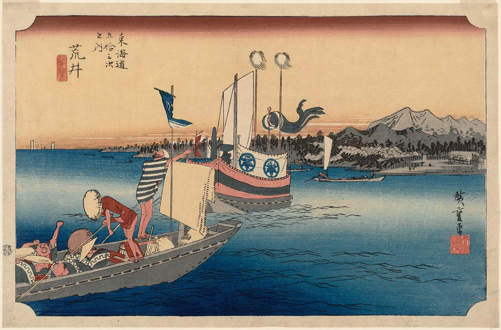
The beginning.
Benjamin Robert Haydon
I was watching the film Mr Turner for the second time the other day and often on a second viewing of a film or the second reading of a book you come across things that you didn’t see the first time around. During the second viewing of the film about Turner I noticed a minor character in it who Turner referred to as Haydon. He was depicted as a “fussy” man who had great money troubles and was constantly approaching Turner for a financial loan. I had never come across an artist named Haydon and it peaked my interest. So, let me share with you a look at the life and works of a very troubled, whom some would say, was a very talented English artist. Let me introduce you to Benjamin Robert Haydon.
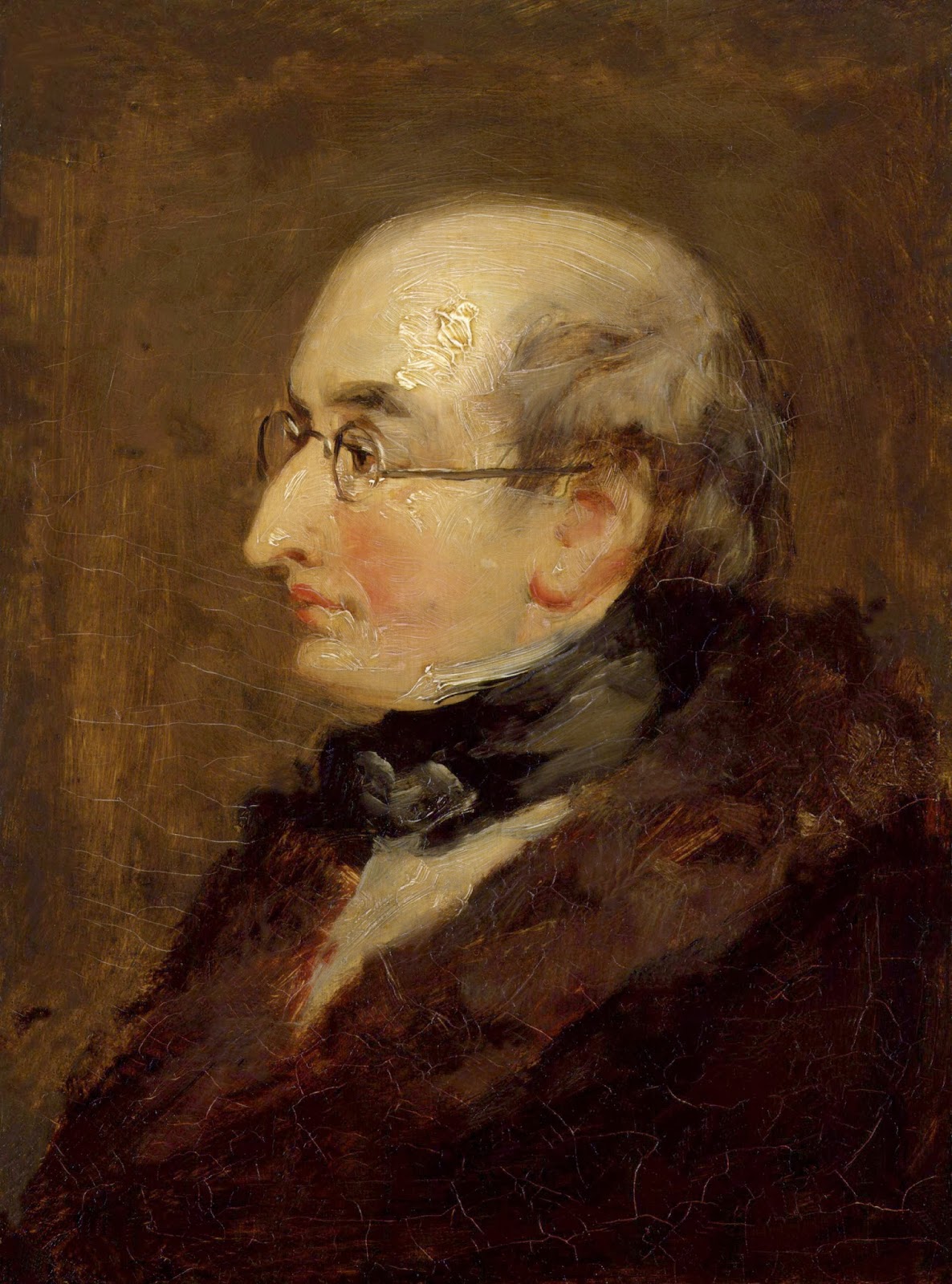
Benjamin Robert Haydon by William Nicholson RSA (c.1820)
Benjamin Robert Haydon was born in Wimpole Street in the south coast English garrison town of Plymouth on January 26th, 1876. He had a younger sister Harriet; another sister, Sarah, had died in infancy. His father was Benjamin Robert Haydon who had married his wife Mary, one of eight children and the second daughter of the Rev. Benjamin Cobley, curate of Shillingford and later, the rector of Dodbrook, near Kingsbridge, in the county of Devon. Haydon’s father was a well-to-do printer, stationer and publisher and had a shop in Plymouth at 75 Market Place. He was also an amateur “special correspondent” to the Bristol Journal, who as he lived in a garrison town, he enjoyed writing about the valorous exploits of the English military heroes fighting for their country in various parts of the world.
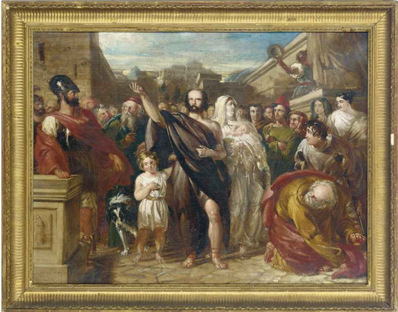
The Banishment of Aristides from Athens by Benjamin Haydon
In 1792 Benjamin Haydon, then aged six, first attended school and it was the start of his interest in sketching and he would often draw rough portraits of his school friends.. The following year, 1793, England and France went to war and it was that same year that seven-year-old Benjamin Haydon attended the Plymouth Grammar School run by the headmaster, the Reverend Dr. Bidlake. Bidlake, Haydon recalled the head painted and played the organ and realising the young Haydon had a love and aptitude for sketching gave him and one of his fellow pupils some painting lessons. That fellow student was Samuel Prout who would later become a renowned watercolourist, and one of the masters of watercolour architectural painting. Bidlake encouraged Haydon to paint landscapes en plein air but this was countered by the advice given to him by a Neapolitan worker in his father’s business, a Mr. Fenzi, who would regale excitedly about the works of Raphael and Michelangelo. Haydon was excited about what he saw and heard and remembered Fenzi’s words of advice about ignoring landscape painting and concentrate on figurative painting:
“…Do not draw de landscape; draw de feegoore, Master Benjamin…”
When Haydon was eleven years old he contracted measles and was laid up in bed. He recalled the time well, as his father visited his bedside to excitedly announce the British naval victory at Cape St Vincent. Later Haydon recalled the excitement in the household with the news of Horatio Nelson’s naval victories.

Plympton Grammar School
(Photograph taken 28 August 2001 © Mr Gerald Rendle)
In 1798, at the age of twelve, Haydon left Plymouth Grammar School and was admitted as a boarder to All Hallows School in Honiton, some sixty miles from his home. Here the headmaster was Reverend William Hayne who was tasked by Haydon’s father to help his son improve his art. In 1800 Reverend William Hayne was offered a teaching post at Plympton Grammar School and he accepted and moved his family and pupils to Plympton St Maurice. In a way it was a return home for Haydon who had spent his early years nearby. Fifty years earlier the grammar school had been where the artist, Sir Joshua Reynolds, studied and Reynold’s father had been the headmaster. In all, Haydon had been under the tutelage of Reverend Hayne for two years at Honiton and a further six months at Plympton Grammar where he rose to become head boy at the age of fifteen and by which time he had acquired a good understanding of the Latin, Greek, and French languages.
Haydon left the school and the world of the classic literature and had to decide on his next move. However, that decision was taken away from him by his father who saw his son as being his successor in the family business and so had his son move to Exeter where he studied business and as Haydon saw it, the dry tuition of profit/loss and ledgers. He was not enamoured by the world of finance and bookkeeping. His course lasted six months at which time he returned home to Plymouth where he was indentured for a period of seven years as an apprentice to his father. Life could not have been worse according to young Haydon who hated everything about the job. He hated everything – his father’s customers, serving behind the counter in his father’s shop, working on his father’s accounts. Nothing pleased him and he would spend long periods of time sulking at his lot in life.
Benjamin Haydon came to the conclusion that his future lay ahead as an artist. His father and his grandfather both had similar thoughts at Benjamin’s age but they soon faded and Benjamin’s father believed the same would happen to his son’s great artistic ambitions. Heated and constant family arguments followed on a daily basis over young Haydon’s future, so much so, Haydon became ill and suffered severe inflammation of his eyes. Benjamin’s father believed this would put an end to his son’s fantasies of becoming an artist and told him he could never become an artist as he couldn’t see properly, but he was mistaken for his son was not to be deflected.
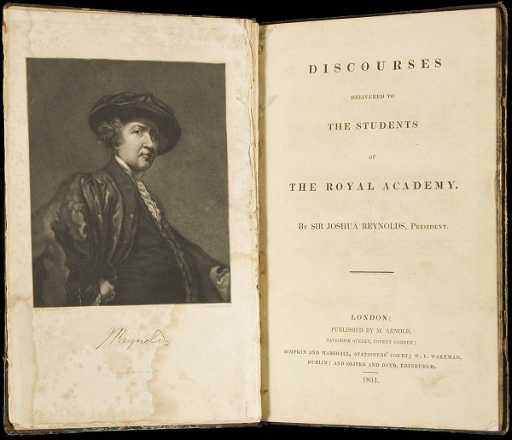
Discourses by Sir Joshua Reynolds
Haydon believed that his eyesight problem was not a major stumbling block and he was buoyed by the words of Joshua Reynolds in his first Discourse he delivered to the Royal Academy during the opening session in January 1769. Reynolds set out his theories on art in a series of fifteen lectures in the Royal Academy Schools, which were later published as Discourses on Art. It was all about the fact that nothing would be achieved without hard work. Reynolds said:
“…But young men have not only this frivolous ambition of being thought masters of execution inciting them on one hand, but also their natural sloth tempting them on the other. They are terrified at the prospect before them of the toil required to attain exactness. The impetuosity of youth is disgusted at the slow approaches of a regular siege, and desires, from mere impatience of labor, to take the citadel by storm. They wish to find some shorter path to excellence and hope to obtain the reward of eminence by other means than those w4iich the indispensable rules of art have prescribed. They must, therefore, be told again and again that labor is the only price of solid fame, and that whatever their force of genius may be, there is no easy method of becoming a good painter…”

Haydon met Samuel Northcote, one of his father’s customers and hearing of young Haydon’s wish to become an artist Northcote advised him to study anatomy. Haydon took that advice and purchased a book at the Plymouth Naval Hospital Auction entitled Tables of the Skeleton and Muscles of the Human Body written by Bernhard Siegfried Albinus in 1749 It cost him two pounds ten shillings, an amount he did not have ! This attitude to buying things he could not afford would haunt him all his life. Haydon rushed home and spoke to his father who grudgingly gave him the money. Haydon immersed himself in the anatomy book and after two weeks of constant studying the drawings and information, he claimed that he knew every muscle and every bone in the human body.
Haydon’s constant battle with his mother and father as to his future continued with neither side relaxing their stance. However, he must have finally worn them down as they finally agreed to him travelling to London and enrolling on a two-year course at the Royal Academy Schools. They gave him an initial twenty pounds to cover the cost of lodgings which he secured in the Strand, close to Somerset House, the home of the Royal Academy. The course was free of charge but to get a place on the course one had to be recommended by an Academician. This was achieved through Haydon’s uncle Benjamin Cobley who contacted his friend and Academician, Prince Hoare. Haydon left Plymouth on an overnight coach on the morning of May 4th 1804 and arrived in London the next day.
Haydon, on arrival in London, took lodgings at 3 Broad Street, Carnaby Market. One of the first outings Haydon made was to the Royal Academy’s thirty-sixth annual exhibition which was being held at Somerset House (The Royal Academy did not move to its present location at Burlington House on Piccadilly until 1868). There was a one shilling entrance fee which entitled you to a catalogue and according to the catalogue outlined the reason for the charge:
“…it was to prevent the Rooms from being filled by improper Persons, to the entire Exclusion of those for whom the Exhibition is apparently intended…”
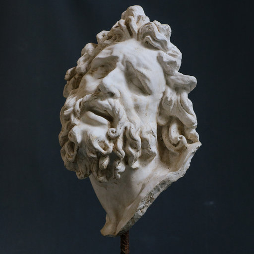
Laocoön’s head
Haydon settled into his course at the Royal Academy Schools and studied hard. He decided that his favoured painting genre would be that of historical paintings. The first stage of his admission to the Royal Academy Schools was to present a drawing from plaster casts and so he immediately went to a seller of plaster casts who had a shop in nearby Drury Lane. Here he purchased a cast of Laocoön’s head, a famous pieces of Hellenistic sculpture, along with some casts of arms, hands and feet and these together with his copy of Albinus’ anatomy book he set about creating acceptable drawings. He worked non-stop and described his daily ritual:
“…I rose when I woke, at three, four or five; drew at anatomy until eight, in chalk from my casts from nine to one and from half-one until five – then walked, dined and to anatomy again from seven to ten and eleven…”
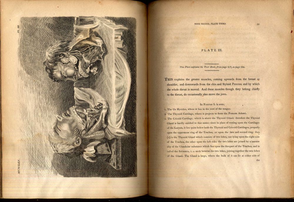
Dissection of the neck from the 1794 book ‘Engravings, Explaining the Anatomy of the Bones, Muscles and Joints’ by John Bell.
Another early purchase Haydon made was a copy of the 1794 book Anatomy of the Bones, Muscles and Joints by John Bell and this was to supplement his Albinus book on anatomy.
It took a while before he made meaningful friendships with the exception of his sponsor and Royal Academy’s Secretary of Foreign Correspondence, Prince Hoare, who, on seeing Haydon’s sketches introduced him to John Opie and James Northcote. Opie concurred with Haydon as to the importance of studying anatomy whereas Northcote advised Haydon to forget about anatomy and historical paintings and concentrate on portraiture but Haydon would not be deterred. At the meetings Haydon spoke to the two artists about whether he should take lessons from a master. Once again Opie and Northcote had differing views. Opie was for it, Northcote against it saying Opie was only interested in extracting money from Haydon and Haydon’s father. In the end he decided to follow Opie’s advice about studying anatomy but Northcote’s advice with regards not working under a master painter.
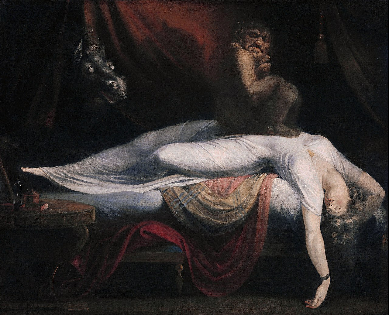
The Nightmare by Fuseli (1781)
On Christmas Eve 1804 Prince Hoare introduced Haydon to the Academy’s Professor of Painting, the Swiss-born painter John Henry Fuseli. Fuseli held the position at the Royal Academy as Keeper, who carried overall responsibility for the Royal Academy Schools. Haydon had seen Fuseli’s “strange” works such as his 1781 painting The Nightmare and his 1802 painting, Uriel watches Saturn on his Flight to Earth, a print of which he remember seeing in his father’s shop and so was delighted to visit this great master in early January and show him his sketches. Fuseli was duly impressed with Haydon’s works and granted him admission to the RA Schools as a Probationer.
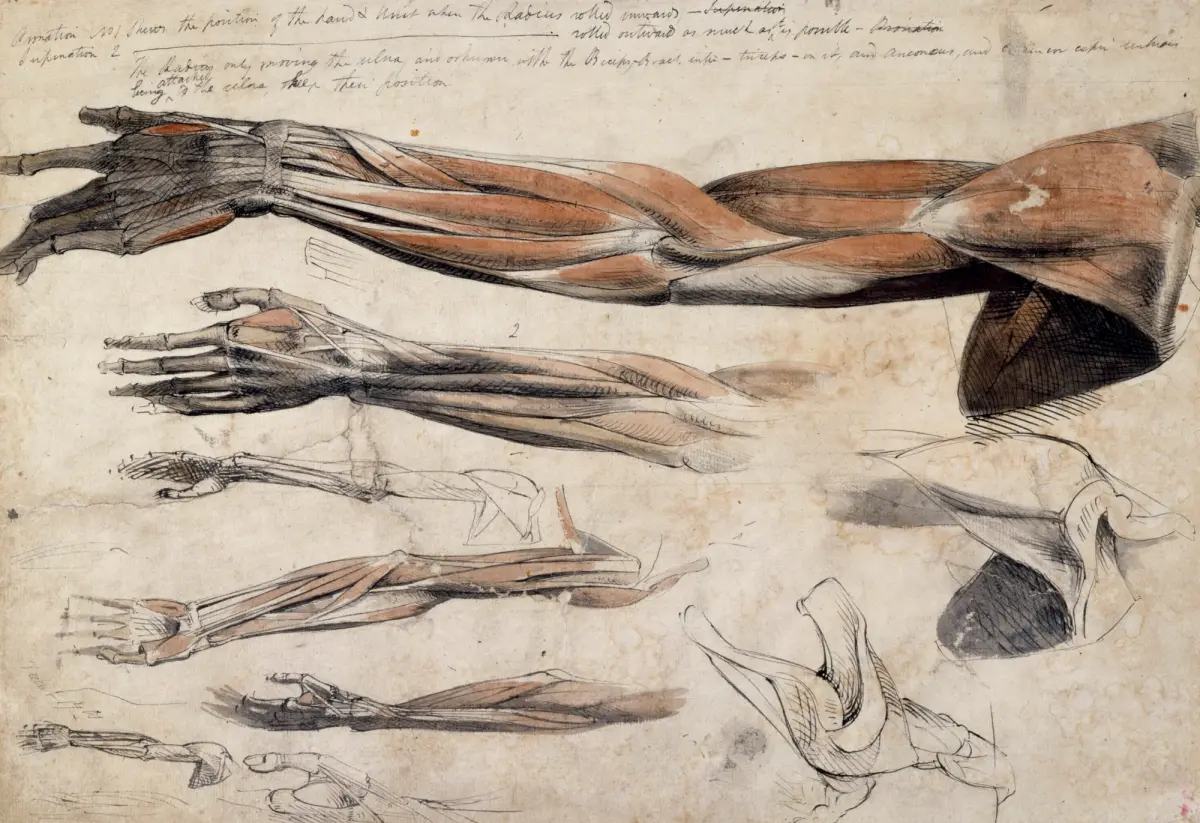
A sheet of anatomical drawings of the bones, muscles and tendons of the arm and hands by Benjamin Haydon (ca. 1805)
One of Haydon’s early tasks he had to perform at the RA School was to copy a cast but the object was set up some distance from him and he realised that his poor sight was going to pose a problem and so had to purchase a pair of spectacles. Haydon continued to work hard and such attitude found favour with Fuseli.
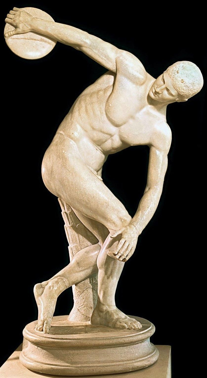
The statue of the athlete Discobulus by Myron (c.450BC)
In March 1804, having completed the task of drawing the figure of Discobolus he received his “ticket” and became a ”Student of Painting”. Shortly after, Haydon was summoned home by his family as his father was dying. However, despite still being a patient at Royal Naval Hospital in Plymouth his father had recovered and Haydon remained in the city that summer. Haydon immediately sought permission from the hospital authorities to draw from their collection of preserved human bones with dried muscle. He drew obsessively, combining his depiction of the specimens with poses typically found in anatomical textbooks.

Anatomical drawing of the bones and muscles of the lower leg by Benjamin Haydon (1805)
The result was an album with a collection of anatomical drawings. Haydon believed that anatomy was the key to comprehending the ‘principles of heroic form’ which would then result in successful completion of grand historical works which was still his artistic aim. His ambition was to become the greatest historical painter England had ever known.
……to be continued
The majority of the information I have used in this and the subsequent blogs on the life of Benjamin Haydon came from an excellent second-hand book, published in 1998, I came across entitled A Genius for Failure, The Life of Benjamin Robert Haydon by Paul O’Keefe. If you are interested in Haydon’s life, I can highly recommend you try to get yourself a copy.