
The middle part of the journey.

The Tokaido Road Post Stations: Edo (1) to Kyoto (55)
The Takaido Road journey was about 500 kilometres long and most travellers made the tiring journey on foot, aiming to accomplish several stages per day although in some cases the travellers would spend several nights at one station. The whole trip, on average, would take two weeks but the more athletic could cut that time by half. One of the determining factors was the weather and bad weather could make the journey last up to a month. As I said in Part 1, one set of travellers who made the annual pilgrimage was the procession of the great daimyo (powerful Japanese magnates, feudal lords), who were commanded to spend every other year at the Shōgun’s court. The reason for this being to prevent them from organizing rebellions and the large entourage travelled back and forth in huge processions numbering hundreds of people.

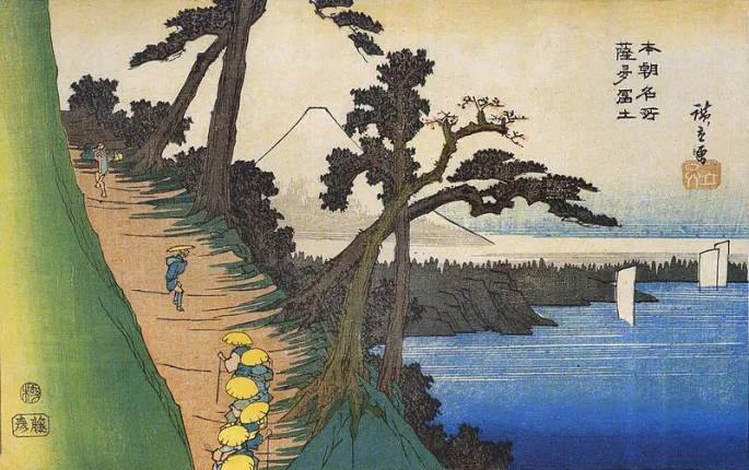
No.17. Yui: Satta Peak by Hiroshige (c.1833).
At the end of the last blog Hiroshige had reached the snow covered village of Kambara. He and his group have moved further south west and arrived at the Satta Pass. In this depiction we see a few travellers on the cliff-top pass looking out at the panoramic Kiyomi Bay, a bay on the Pacific coast of Honshū. The Satta Pass was carved out of the rocks in 1655. Two pine trees can be seen leaning over and twisted in the wind and in the background we once again see Mount Fuji.

Yui: The Dangerous Satta Pass by Hiroshige (1855)
Hiroshige completed another print of the Satta Pass in his 1855 Tokaido Road series.
Travellers on a mountain path along the coast by Hiroshige (c.1837)
Hiroshige must have been fascinated by the view afforded to him from the Satta Pass and Mount Fuji as one of his prints from his Famous Views of our Country is entitled Travellers on a Mountain Path along the Coast and once again we see travellers trekking along the Satta Path.
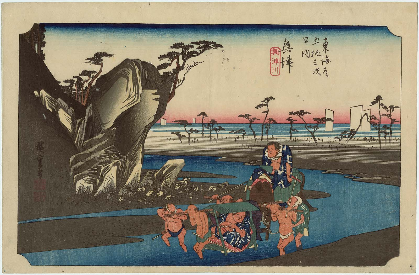
No.18. Okitsu: The Okitsu River by Hiroshige.
The Takaido Road travellers leave Yui and the Satta Pass and cross the Okitsu River towards the layby station at Okitsu. The classic ukijo-e print by Hiroshige depicts two sumo wrestlers being carried across the Okitsu River, one on a packhorse and the other in a kago, which is a type of litter used as a means of human transportation by the non-samurai class in feudal Japan.
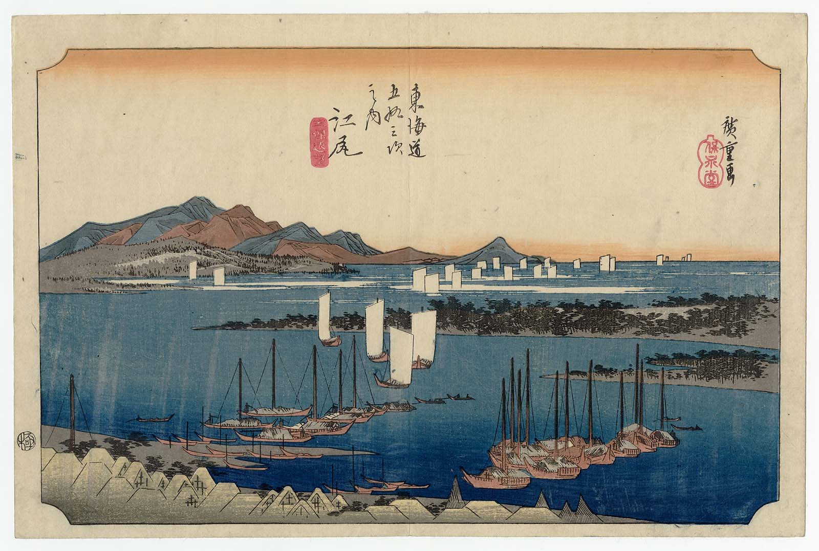
No.19. Ejiri: Distant View of Miho by Hiroshige (c.1833).
Further along the Takaido Road the travellers are able to look towards the sea and the harbour town of Ejiri. Ejiri was a castle town. Ejiri castle was built in 1570, but the town of Ejiri was not officially designated a post station until the early 17th century. The print depicts a view over the Miho no Matsubara,(pine grove at Miho), a scenic area on the Miho Peninsular of Shizuoka City. Its seven-kilometre seashore is lined with pine trees. with boats anchored in the foreground in front of a fishing village, while others can be seen sailing in Suruga Bay.

No.20. Fuchū: The Abe River by Hiroshige (c.1833).
The weather was always a determining factor for how long the five hundred kilometre journey would take but the other factor was the crossing of rivers that traversed their path. One such was the Abe River which proved a great challenge. depicts travellers crossing the Abe River to the west of the post station. A woman is being carried in a kago (another type of litter, while other people are fording the stream on foot.

No.21. Mariko – Local Specialities Shop by Hiroshige (c.1833).
We have now arrived at the twenty-first stop over point near Mariko and in this depiction we see two travellers who have stopped their journey for refreshments at a roadside stall. Tea is being served with a local speciality known as tororoshiru, which is a paste made from grated yam. The two men are being served by a woman who has a baby strapped to her back. To the left of the stall we see a man on his way along the road with his back to us. He is smoking a pipe and his rain jacket and hat are tied to a stick which he carries over his shoulder.
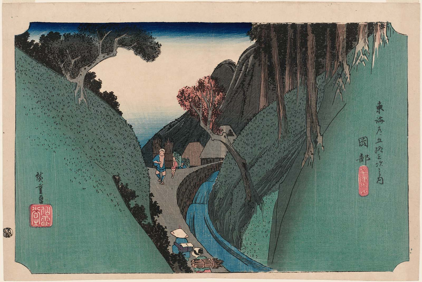
No.22. Okabe: Utsu Mountain by Hiroshige (c.1833).
Once again the travellers had to struggle along the tiring uphill stretch of the Tokaido Road as they move slowly over the Utsu Mountain pass. Most of the post stations I am highlighting in these three blogs were built around 1602 but the one at Okabe was not completed until a year later. At the time it was built, the population there was just sixteen and thirty-five years later, had only risen to one hundred. The print depicts a mountain stream between steep green banks, with the roadway a narrow path walled in on one side by a stone wall. it was destroyed by fire in 1834. After it was rebuilt in 1836, it was eventually named nationally designated Important Cultural Property. In 2000, it was reopened as an archives museum.

No. 23. Fujieda: Changing Porters and Horses by Hiroshige (c.1833).
Such a long journey along the 500 km Tokaido Road necessitated a frequent change of horses and men who have been employed to carry people and supplies across fast flowing rivers and up steep mountain trails. Fujieda was one of these stop-off points between the Abe and Ōi rivers, where fresh horses and men could be employed for the onward route.

No. 24. Shimada: The Suruga Bank of the Ōi River by Hiroshige (c.1833)
With fresh horses and a new group of porters to carry supplies, the palanquins and the party were ready to cross the Ōi River which flowed down from the Akaishi mountains, part of the the Japanese Southern Alp that form the border between Shizuoka, Nagano and Yamanashi prefectures. From the print we can see that the crossing was an immense challenge. The Tokugawa Shogunate was very mindful about the defence of Edo and that included the outer limits of the city. It was then deemed necessary to stop any easy access to Edo expressly forbidding the building of bridges or allowing a ferry service to cross the Ōi River. All travellers had to wade across the shallowest parts of the river but this was impossible during times of heavy rain which caused the river to flood. During those times travellers had to spend days at Shimada, which of course made the tea houses and shop owners very happy.

No.25. Kanaya: The Far Bank of the Ōi River by Hiroshige (c.1833)
The twenty-fifth woodcut print of the Tokaido Road series by Hiroshige depicts the party at the end of their struggle to cross the Ōi River and to approach the Kanaya post town. Kanaya was located on the west bank of the Ōi River and like Shimada, prospered from the Tokugawa Shogunate’s defence policy of not allowing any bridge or ferry to be established on the Ōi River. This meant reaching the town from the east was often difficult if the river flow, after heavy rain, was too fast for travellers to cross and they had to wait before entering the river finding themselves trapped for days on either side awaiting the water level to drop.

No.26. Nissaka. Sayo Mountain Pass by Hiroshige (c.1833)
Having crossed the Ōi River the party of travellers moves into the Sayo mountains and once again face a steep up-hill climb. On the path we see a large stone. This object appears in a later woodcut print by Hiroshige.
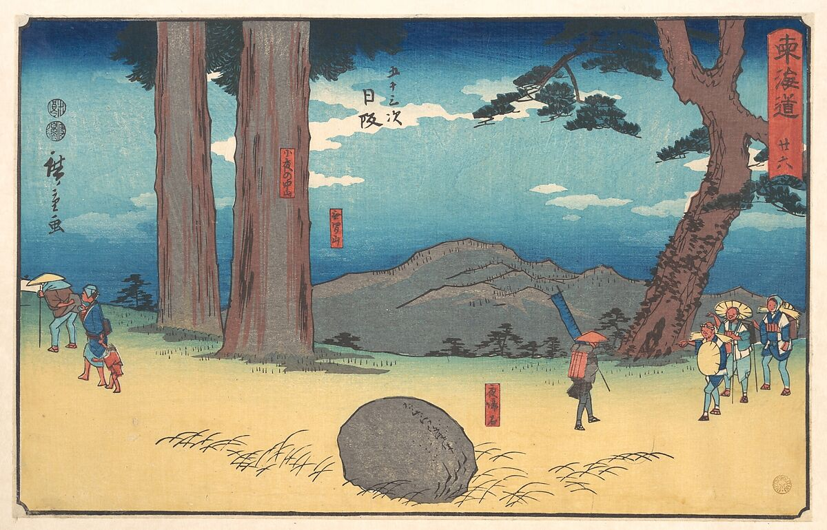
Nissaka by Hiroshige (1849)
The stone features prominently in this print. It is known as the Night-Weeping Stone and according to legend a pregnant woman was killed by bandits, and her blood fell on the stone. After she died, a passing priest heard the stone call out for him to rescue the surviving infant. The tale goes that the stone has cried at night for her.
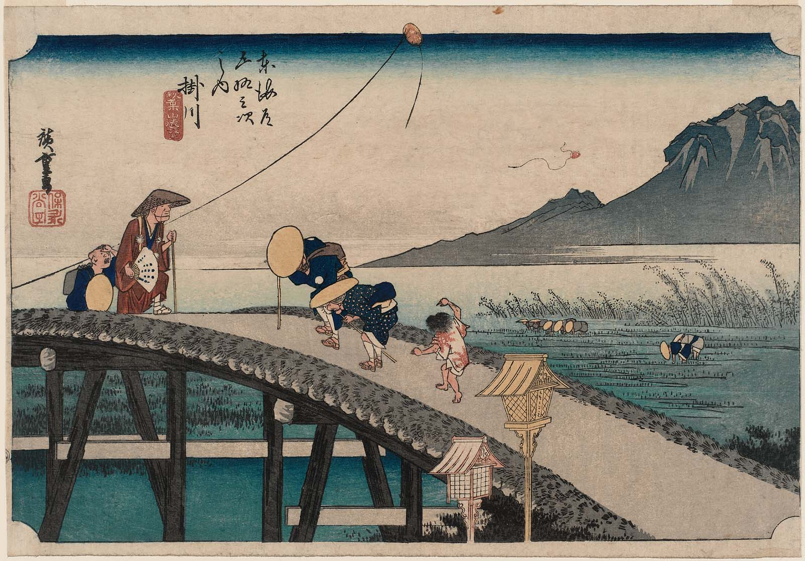
No.27. Kakegawa – View of Akiba Mountain by Hiroshiga (c.1833)
This woodblock print depicts a priest and boy and elderly pilgrims crossing the trestle bridge. To the right we see farmers planting crops in the fields, and in the background on the right we get a distant view of Mount Akiba. An old couple is struggling against a strong wind, followed by a boy making a mocking gesture; another boy is watching a kite floating up in the air.
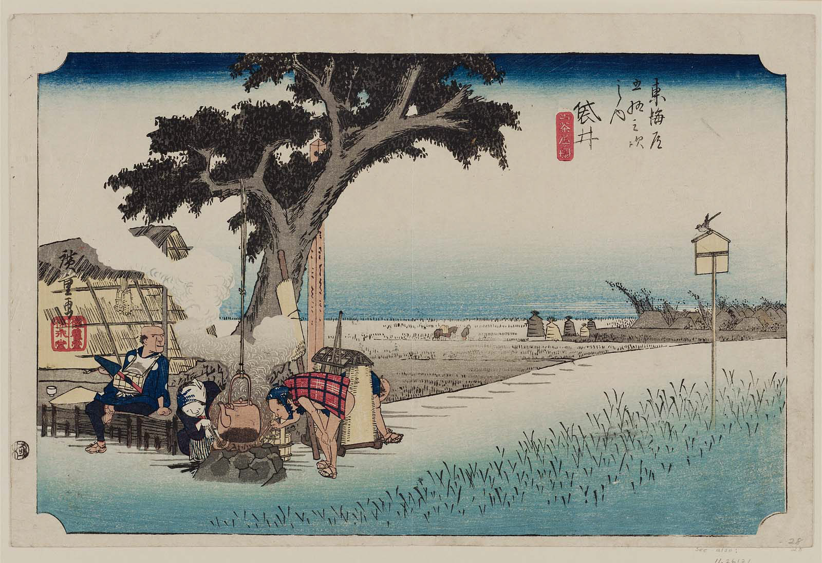
No. 28. Fukuroi: Tea Stall by Hiroshige (c.1833)
The twenty-eighth print in the Tokaido Road series is one depicting a tea stall at the small town of Fukuroi. This was a much needed and much appreciated stop-off point for the travellers who had trekked up steep mountain passes and forded fast flowing rivers. Although only a small town at the time of Hiroshige’s visit, within a hundred and twenty-five years it had grown and was given city status in 1958. We see a couple of travelers sheltering at a wayside lean-to, in front of which a woman stirs a large kettle which hangs from the branch of a large tree. The surrounding area appears to be featureless rice fields, with little indication of a post town.

No.29. Mitsuke: Tenryū River View by Hiroshige (c.1833)
The Tokaido Road procession has reached the town of Mitsuke and are facing yet another river to cross. This time it is the Tenryū River which has flowed two hundred kilometres south from its source, Lake Suwa. The river drains into a wide coastal plain noted for fruit and rice production. The print portrays a close-up scene along the Tokaido Road which depicts the difficult and laborious crossing of the Tenryu River close to the point it reaches the sea. In the foreground, we see two ferrymen waiting for their passengers who are on this long trek.
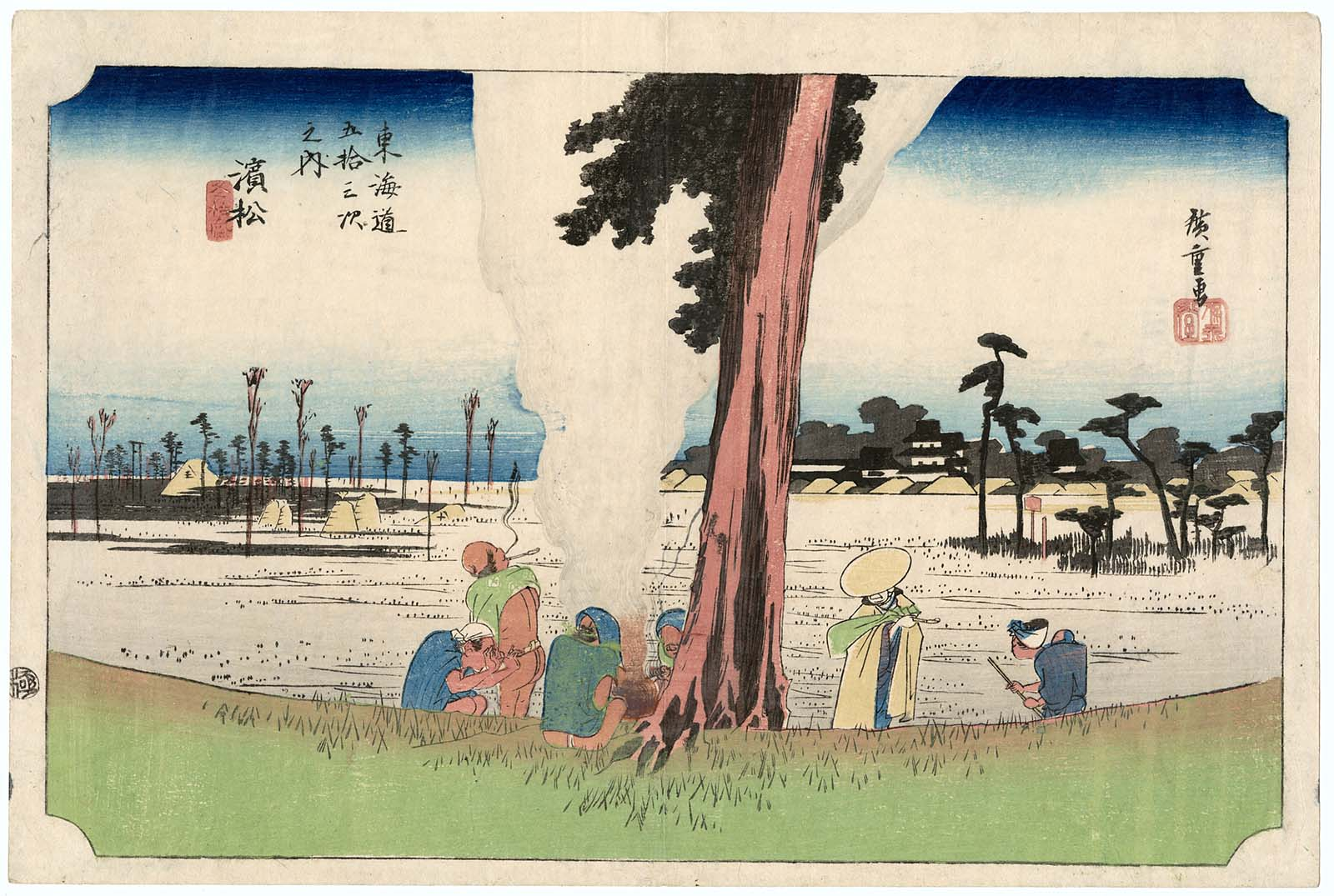
No.30. Hamamatsu: Winter Scene by Hiroshige (c.1833)
The party of Tokaido Road travellers have successfully crossed the Tenryū River and arrived at Hamamatsu. Hamamatsu flourished during the Edo Period under a succession of Daimyo rulers as a castle city, and a postal city on the Tokaido Road. In this print we see some of the procession huddled together trying to counteract the harsh winter conditions.

No.31. Maisaka: View of Imagiri by Hiroshige
The party arrive at Maisaka and the woodblock print is looking back at the Imagiri Promontory. As the Tokaido Road links the shogun’s headquarters in Edo with the imperial capital in Kyoto, its route runs along the Pacific coast and so many of the woodcut print images from the series are seascapes. The depiction we see shows a view of Imagiri Beach near Maisaka. We look inland from the beach and see Lake Hamana, which empties into the Pacific Ocean. Our group of travellers heading west had to take a ferry across the lake. In the foreground we see brown-red pilings which were erected to protect the ferry port from the open sea.
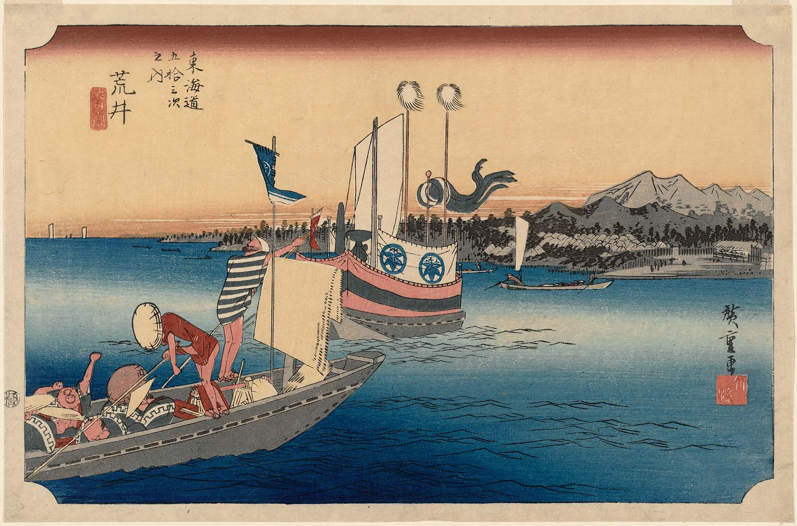
No.32. Arai Ferryboat by Hiroshige (c.1833)
Hiroshige left Maisaka with his party which included one of Japan’s powerful lords, known as a diamyo, along with his entourage and headed for the next lay-over station at Arai. However, to reach Arai they had to cross a large stretch of water, Lake Hamana. To accomplish this the party organised boats to transport the people and provisions.
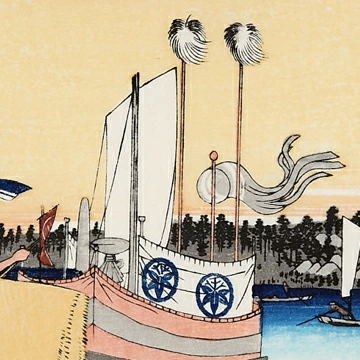
The diamyo’s boat
In the centre of the painting we see a ferry, carrying the daimyo, crossing the water, heading to Arai. The large boat is fitted with a sea curtain to protect the powerful dignitary from any inclement weather they should encounter during the crossing. It has hangings marked with circular symbols, the lord’s family crest.
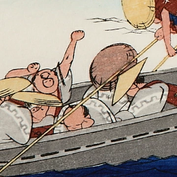
The Attendants
In the foreground, we can observe the daimyo’s attendants in a separate boat. It is interesting to look at their facial expressions and their countenances. Some looked bored while others yawn or lie back asleep. They are fed up and exhausted after their long trek.
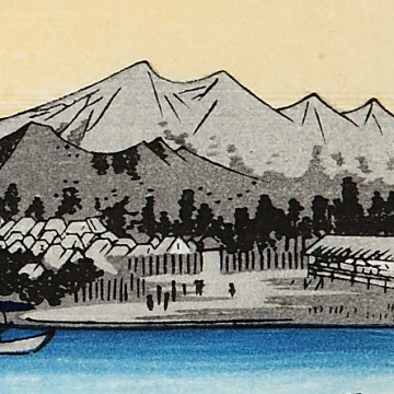
The Arai Fortification
On the far side of the lake we can see the Arai barrier which was a fortification built by Tokugawa Ieyasu around 1600.

No.33. Shirasuka: View of Shiomizaka by Hiroshige (c.1833)
The post station of Shirasuka is seen in this depiction situated on a high plateau. However this was not the original site of Shirasuka as originally it was found close to the shore. This all changed with the earthquake which hit the country in 1707, with the ensuing tsunami overwhelming the region and destroying the twenty-seven inns. Following this natural disaster the post station was moved to site high above the coastal plain. The next stop along the coast will be Futagawa. Many hill roads in Japan bear the name Shiomizaka. The name has two meanings in the Japanese language, the most common is one is “watch the tide” and another is “see death.”

No.34. Futagawa: Monkey Plateau by Hiroshige (c.1833)
The town of Futagawa was formed in 1601 with the merging of two villages, Futagawa and Ōiwa which were a kilometre apart and the townspeople were instructed to look after the travellers who were making the trek along the Tokaido highway. This didn’t work well and so, in 1644, the Tokugawa shogunate had the village of Futagawa moved westwards and the village of Ōiwa moved further to the east. The post station was re-established in Futagawa’s new location, and an Ai no Shuku was built in Ōiwa. Ai no Shuku were unofficial post stations but were not officially designated rest areas, and travellers along the roads were not allowed to stay in these post stations. The print depicts a rather gloomy landscape and we see the weary travellers having scaled the hill, arrive at a free-standing tea house. The quality of the soil in this area is poor and the area as become a barren wasteland with only small pine trees and shrubs seen to be growing.
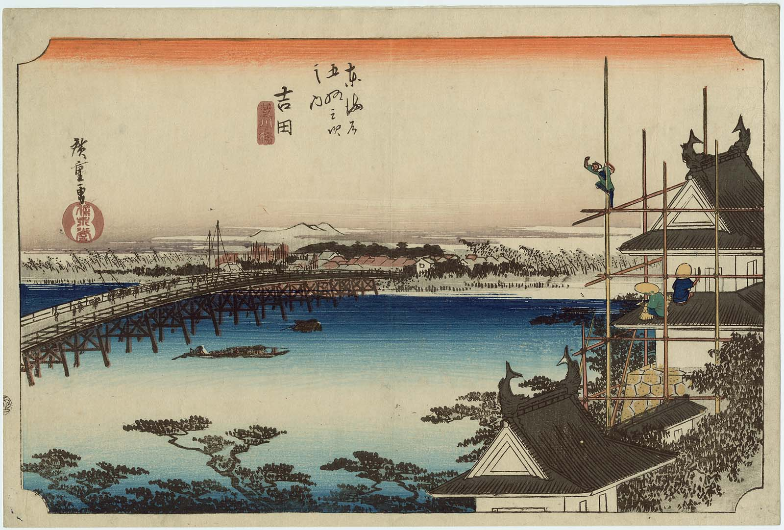
No.35. Yoshida: The Toyokawa River Bridge by Hiroshige
The post station of Yoshida was two hundred and eighty-seven kilometres from the starting point of the journey at Edo. The travellers had covered just over half their long journey. Yoshida lay almost half way between the post station of Nihonbashi to the west, and Futagawa to the east. The post station within the castle town of Yoshida came into being in 1601. At Yoshida there was a long bridge which spanned the Tokugawa River. This was an important bridge for the travellers as it was the only one they could use as deemed by the Tokugawa shogunate. The post station at Yoshida was one of the largest stations and stretched two and a half kilometres along the Tōkaidō Road and the census of 1802 noted that the station comprised of two honjin (inns for government officials), one waki-honjin (secondary inn in a post-town which provided lodging to second ranking official travellers) and sixty-five hatago (lodging housess for travellers). The print by Hiroshige depicts the famous bridge at Yoshida, as well as Yoshida Castle.
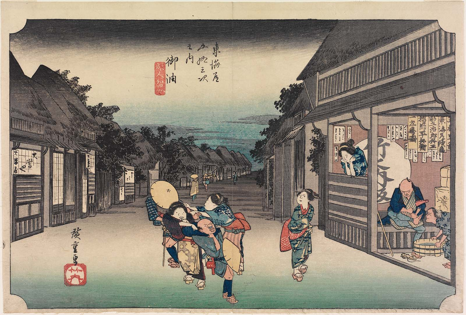
No. 36. Goyu: Women Stopping Travellers by Hiroshige
This classic ukiyo-e print by Andō Hiroshige depicts the main street of the post town at Goyu at dusk, with aggressive female touts, who were infamous characters around this post station. Their “role” was to entice/drag travellers into the teahouses and inns for a night of entertainment.
In the next blog I will look at the final stages of the Tokaido Road trek which Hiroshige took part in 1832.

Hi I have just found your blog as I have reserched about the Dutch artists. Your blog is really great and I am just wrting you how your intersts and knowledge is authentic ! Are you in Japan now? I am Japanese living near Kyoto and I hope you enjoy your trip !!