The Tokaido Road Trip. Part 3.

The end is in sight

The Tokaido Road

Hiroshige’s journey is over two-thirds complete. In the last blog he and his party had arrived at Arai and now the Tokaido Road travellers head in a westerly direction, following the coast as it approaches Shiomizaka,

No.37. Akasaka: Inn with Serving Maids by Hiroshige

Along with the preceding post stations of Yoshida and Goyu, the one at Akasaka was well known for its meshimori onna. Meshimori onna, which literally translates to “meal-serving woman,” is the Japanese term for the women who were hired by the hatago inns on the Tokaido Road post stations. At first their role was that of simply maidservants on the payroll of the inns, but as the traffic along became busier and the kaidō (road) grew,  competition between the inns increased, and the ladies were often engaged in prostitution.  However, in 1718 the Tokugawa shogunate laid down a law which stated that the number of meshimori onna working at each inn would be limited to two and this was seen as tacit permission to employ a limited number of prostitutes.  Hiroshige’s print depicts a typical inn and it is divided in half by a sago palm in the centre of the work. To the left we see travellers partaking of an evening meal.  On the right, we see prostitutes  putting on make-up and preparing for the evening entertainment.

No.38. Fujikawa: Scene at Post Outskirts by Hiroshige

At its peak, Fujikawa was once a large stop over town with 302 buildings. Its total population was approximately 1,200 people. In this ukiyo-e print by Hiroshige the artist has depicted a daimyō procession on their trek along the Tokaido Road entering the post station.  We see three commoners kneeling as the lord’s retinue passes by.  A line of old pine trees extend for approximately a kilometre mark the location of the Tōkaidō Road.

No.39. Okazaki: Yahagi Bridge by Hiroshige

Okazaki was a part of the thriving castle town which encircled Okazaki Castle, the headquarters for Okazaki Domain. The thirty-ninth print of the series depicts the Yahagibashi bridge.  This magnificent structure was one of the few bridges that people were permitted to use on the Tokaido Road by the Tokugawa shogunate.  It was one of the longest bridges built in Japan during the early Edo period. On the opposite bank of the river we can see Okazaki Castle.

No.40. Chiryū: Early Summer Horse Fair

Chiryū was the thirty-ninth of fifty-three stations of the Tōkaidō and counting the print featuring the Edo starting point at Nihonbashi, the fortieth of the woodblock series.  Reaching this point meant the travellers had trekked for three hundred and thirty kilometres and would have probably taken, on average, two weeks.  The town was famed for its horse market which took place in late April and early May.  Tall pine trees can be seen and the shogun, Tokugawa Ieyasu, ordered that the post station plant pine trees along through route of the highway before and after the town.  These all survived until the Isewan Typhoon of 1959 which destroyed most of them.

No.41. Narumi: Famous Arimatsu Tie-dyed Fabric

 The woodblock print depicts travellers passing by open-fronted shops selling tie-died cloth. Clothing such as the yukata kimono, the unlined kimono for summer use, which was a local speciality of the region.

No.42. Miya: Festival of the Atsuta Shrine

The Tokaido Road post station at Miya also acts as a post station on the The Nakasendō, the Central Mountain Route, also known as the Kisokaidō, which was one of the five routes of the Edo period, that connected Edo and Kyoto.  Hiroshige’s print depicts two gangs of men dragging a portable shrine cart which is just out of the picture, past a huge torii gate. The torii gate is the symbol of a Shinto shrine, and the name of the town, “Miya” also means a “Shinto shrine. The shrine in question is the famous Atsuta Shrine, one of the most famous in Japan and a popular pilgrimage destination in the Edo period.

No.43. Kuwana: Shichiri Crossing

The Kuwana post station was found in the castle town of Kuwana Domain, which was a major security installation on the Tōkaidō Road for the Tokugawa shogunate. The actual post station could be found located on the western shores of the Ibi River. Hiroshige’s print of Kuwana depicts two large ships of the Shichiri no watashi ferries about to set sail with travellers from in front of Kuwana Castle, whilst in the background we can see other ships sailing away on their voyages.

No. 44. Yokkaichi: Mie River by Hiroshige

Hiroshige’s ukiyo-e print of Yokkaichi  illustrates a stormy day and we see a man running after his hat which has been blown from his head.  Another man crosses a small bridge over the Sanju River  The roofs of the small group of huts which form the post station can be seen in the middle of a marsh are almost hidden by the reeds.

No. 45. Ishiyakushi: Ishiyakushi Temple by Hiroshige

The Ishiyakushi post station derived that name from the nearby Buddhist temple which is said to have been founded in 726 AD by the shugendō monk Taichō. According to the temple legend, Kūkai carved an image of Yakushi Nyorai on a huge boulder that was found in the forest, and Taichō later built a temple around this image. A settlement gradually developed around the temple.  Utagawa Hiroshige’s ukiyo-e print of Ishiyakushi depicts the temple in the midst of a grove of trees on the left and a village on the right.  Rising in the background are the Suzuka Mountains.  In the foreground we can see bales of rice which means that this is an Autumn depiction and tells us that this post station is at the heart of the countryside.

No.46. Shōno: Driving Rain

The weary travellers are suddenly caught out by torrential downpour as they arrive at the town of Shōno in Ise Province. On the right we see two men heading down hill, one holding an umbrellas and the other wearing a hat and cloak. There are two inscriptions on the umbrella. One is Takenouchi who was the publisher of the series of prints and the other is Gojūsan-tsugi, which was part of the Japanese name of the Tokaido Road woodblock series Tōkaidō Gojūsan-tsugi no uchi. To the left of these men we see another man wearing a hat and a cloak walking uphill followed by two litter-bearers. The falling of heavy rain is depicted like a grey curtain.

No.47. Kameyama: Clear Weather after Snow

The procession of travellers continue on an upward trajectory. The steep path takes them past the castle of Ishikmawa daimyo and we can just see the town of Kameyama in the valley to the left. The castle was home to the Ishikawa clan,  daimyō of Ise-Kameyama Domain.  The setting is early sunrise and the sky is reddened by the early morning sun. Kameyama was a well fortified city from the middle of the sixteenth century at the time of the building of the castle. In 1854, twenty years after Hiroshige’s woodblock print series was published, the castle was destroyed by the great Ansei earthquake. However in 1855 Hiroshige produced a vertical woodblock series of the Tokaido Road journey and in that series, despite the destruction of the castle, it is depicted in an unblemished state !

No.48. Seki: Early Departure of a Daimyō

The next depiction in the Tokaido series is that of the inn at Seki where the travellers had rested for the night. It is early the next morning and still somewhat dark. The people prepare to set off on the day’s travels. The innkeeper dressed in his traditional kamishimo, a formal kimono for men, stands on the verandah issuing instructions to one of his servants. To the left of the table we see a palanquin (litter) on the ground with the palanquin bearers standing by. The banners we see hanging around the courtyard of the inn probably bear the emblem of the daimyō who has spent the night at the inn. You can see some small brown signs hanging above the head of the innkeeper – they are advertising the availability at the inn of the famous Senjoko and Biojoko brands of white face-powder.

Snow landscape with a gate: Seki by Hiroshige (1855)

The town of Seki also appeared in the 1855 version of Hiroshige woodblock series of the Tokaido Road, the so-called Reisho Tokaido. In this depiction it is late afternoon on a snowy day and we see a few travellers passing the gate to the pilgrim’s route to Iso.

No.49. Sakanoshita: Fudesute Mountain by Hiroshige (c.1833)

Having left Seki, the travellers move deeper inland and have reached the summit of the Fudesute Mountain. The mountain derives its unusual name from an incident in which the celebrated artist Kano Motonobu threw away (sute) his brushes (fude) when he could not capture the beauty of the mountain in a painting.  

Another version by Hiroshige of Fudesute Mountain at Sakanoshita.

No.50. Spring Rain at Tsuchiyama by Hiroshige (c.1833)

The fiftieth print in the series depicts a daimyō procession.  They are enduring torrential rain as they traverse the crossing surrounded by a raging torrent which rushes below a wooden bridge. The post station, with its darkly coloured buildings, partly hidden by trees, are seen to the left of the picture.

Below are two prints made by Hiroshige of the remote Minakuchi layby station. One was part of the 1833 series and the other from the later series which was published around 1852 and known as the Reisho Tokaido or the Marusei Tokaido..

No.51. Minakuchi: Famous Dried Gourd by Hiroshige (c.1833)

In the 1833 print we see a lone traveller walking through the village of Minakuchi. In the foreground we observe women peeling and drying gourds In the background there is a range of hills. This resting station is located in a desolate rural area and was famous for its production of dried gourd shavings which were often used for Japanese dishes. These women we see are busy producing them. One is shaving a gourd, one, with a baby slung on her back, is helping the shaver, whilst another one is drying the shaved gourd on a rope.

The beautiful pines at Hiramatsuyama by Hiroshige (1851-2)

In this 1852 edition of the Reisho Tokaido we see a peasant leading an ox laden with produce making their way slowly along the winding uphill path. Another man follows. The setting of this print is the steep road leading to the next stop-over point at Ishibe and just to the left of the Tokaido Road. This hill between the villages of Harimura and Kojibukuro, although it only reaches an elevation of two hundred and twenty-eight metres, is known as Mount Hiramatsu. The striking thing about the depiction are the pine trees on either side of the road. Normally pine trees along the side of the road have been planted but these are said to have grown there on their own accord. Note in the background the white clouds depicted by Hiroshige. These cumulus clouds were a Western element, one which only rarely appeared in Hiroshige’s prints.

No. 52. Ishibe: Megawa Village by Hiroshige

Utagawa Hiroshige’s ukiyo-e Hōeidō edition print of Ishibe does not actually show the post station at all, but instead we see a tea house known as Ise-ya, which was located at Megawa no Sato, on the road between Kusatsu and Ishiba.  This shop was well-known for its tokoroten, a sticky sweet made from agar, and kuromitsu, a black sugar syrup. We see depicted in the print a group of travellers who seem to be dancing and cavorting in front of the shop.  They are observed by three women who are wearing travelling hats and walking sticks.  A couple of other travellers, some distance further down the road, are seen to be heavily laden, and struggling with their trek.

No.53. Kusatsu: Famous Post House by Hiroshige (1833)

The post station on the Tokaido Road at Kusatu was also a post station for the The Nakasendō (Central Mountain Route), also known as the Kisokaidō, both being one of the five routes of the Edo period.  Looking at the print we observe a busy scene within the post station itself in front of the open-fronted Yōrō-tei, a tea house in which many patrons are probably partaking in their famous Ubagamochi, a sweetened sticky rice cake which was a speciality of Kusatsu.   In front of the tea house, on the road itself, we see a passenger in an open kago (palanquin) holding desperately on to a rope as the porters rush him to his destination  Moving in the opposite direction we see a larger green, covered kago, and this is probably transporting a high status passenger.

No. 54. Ōtsu: Hashirii Teahouse by Hiroshige

The Ōtsu post station was the last of the fifty-three stations of the Tōkaidō as well as the last of the sixty-nine stations of the Nakasendō. In Hiroshige’s 1833 depiction we see oxcarts, heavily laden with bushels of rice or charcoal descending the street. The oxcarts pass in front of the open front of the Hashirii teahouse, which was a popular resting point on the highway, and was well known for its delicacy known as Hashirii Mochi, a sweet rice cake, which is still a local specialty of Ōtsu.  In front of the teahouse is a well from which fresh water gushes out.

No. 55. Kyōto: The Great Bridge at Sanjō by Hiroshige

Finally the weary travellers arrive at the Great Sanjō Bridge over the Kamo River in Kyoto, the imperial capital and the terminal of the Tōkaidō. The bridge is well known because it served as the final location for journeying on both the Nakasendō and the Tōkaidō, two of the famous “Five Routes” for long distance travelers during the Edo period in Japan’s past. In the background we can see houses, temples, and villas at the foot of Higashiyama. Mount Hiei, which is an important Buddhist centre, is silhouetted in distance.

That is the end of our 500 kilometres journey. Most of the pictures came from the website: The Fifty-three Stations of the Tōkaidō Road

(https://hiroshige.org.uk/Tokaido_Series/Tokaido_Great.htm)

The information about the journey came from the usual internet sources and a great book I found in a second-hand bookshop entitled Hiroshige, a Royal Academy of Arts, Publication, produced at the time of their 1997 exhibition of Hiroshige’s work.

The Tokaido Road Trip. Part 2.

The middle part of the journey.

The Tokaido Road Post Stations: Edo (1) to Kyoto (55)

 The Takaido Road journey was about 500 kilometres long and most travellers made the tiring journey on foot, aiming to accomplish several stages per day although in some cases the travellers would spend several nights at one station.  The whole trip, on average, would take two weeks but the more athletic could cut that time  by half.  One of the determining factors was the weather and bad weather could make the journey last up to a month.  As I said in Part 1, one set of travellers who made the annual pilgrimage was the procession of the great daimyo (powerful Japanese magnates, feudal lords), who were commanded to spend every other year at the Shōgun’s court.  The reason for this being to prevent them from organizing rebellions and the large entourage travelled back and forth in huge processions numbering hundreds of people.

No.17. Yui: Satta Peak by Hiroshige (c.1833).

At the end of the last blog Hiroshige had reached the snow covered village of Kambara. He and his group have moved further south west and arrived at the Satta Pass. In this depiction we see a few travellers on the cliff-top pass looking out at the panoramic Kiyomi Bay, a bay on the Pacific coast of Honshū. The Satta Pass was carved out of the rocks in 1655. Two pine trees can be seen leaning over and twisted in the wind and in the background we once again see Mount Fuji.

Yui: The Dangerous Satta Pass by Hiroshige (1855)

Hiroshige completed another print of the Satta Pass in his 1855 Tokaido Road series.

Travellers on a mountain path along the coast by Hiroshige (c.1837)

Hiroshige must have been fascinated by the view afforded to him from the Satta Pass and Mount Fuji as one of his prints from his Famous Views of our Country is entitled Travellers on a Mountain Path along the Coast and once again we see travellers trekking along the Satta Path.

No.18. Okitsu: The Okitsu River by Hiroshige.

The Takaido Road travellers leave Yui and the Satta Pass and cross the Okitsu River towards the layby station at Okitsu. The classic ukijo-e print by Hiroshige depicts two sumo wrestlers being carried across the Okitsu River, one on a packhorse and the other in a kago, which is a type of litter used as a means of human transportation by the non-samurai class in feudal Japan.

No.19. Ejiri: Distant View of Miho by Hiroshige (c.1833).

Further along the Takaido Road the travellers are able to look towards the sea and the harbour town of Ejiri. Ejiri was a castle town.  Ejiri castle was built in 1570, but the town of Ejiri was not officially designated a post station until the early 17th century.  The print depicts a view over the Miho no Matsubara,(pine grove at Miho), a scenic area on the Miho Peninsular of Shizuoka City. Its seven-kilometre seashore is lined with pine trees. with boats anchored in the foreground in front of a fishing village, while others can be seen sailing in Suruga Bay.

No.20. Fuchū: The Abe River by Hiroshige (c.1833).

The weather was always a determining factor for how long the five hundred kilometre journey would take but the other factor was the crossing of rivers that traversed their path. One such was the Abe River which proved a great challenge. depicts travellers crossing the Abe River to the west of the post station. A woman is being carried in a kago (another type of litter, while other people are fording the stream on foot.

No.21. Mariko – Local Specialities Shop by Hiroshige (c.1833).

We have now arrived at the twenty-first stop over point near Mariko and in this depiction we see two travellers who have stopped their journey for refreshments at a roadside stall. Tea is being served with a local speciality known as tororoshiru, which is a paste made from grated yam. The two men are being served by a woman who has a baby strapped to her back. To the left of the stall we see a man on his way along the road with his back to us. He is smoking a pipe and his rain jacket and hat are tied to a stick which he carries over his shoulder.

No.22. Okabe: Utsu Mountain by Hiroshige (c.1833).

Once again the travellers had to struggle along the tiring uphill stretch of the Tokaido Road as they move slowly over the Utsu Mountain pass. Most of the post stations I am highlighting in these three blogs were built around 1602 but the one at Okabe was not completed until a year later.  At the time it was built, the population there was just sixteen and thirty-five years later, had only risen to one hundred.  The print depicts a mountain stream between steep green banks, with the roadway a narrow path walled in on one side by a stone wall.  it was destroyed by fire in 1834. After it was rebuilt in 1836, it was eventually named nationally designated Important Cultural Property.  In 2000, it was reopened as an archives museum.

No. 23. Fujieda: Changing Porters and Horses by Hiroshige (c.1833).

Such a long journey along the 500 km Tokaido Road necessitated a frequent change of horses and men who have been employed to carry people and supplies across fast flowing rivers and up steep mountain trails. Fujieda was one of these stop-off points between the Abe and Ōi rivers, where fresh horses and men could be employed for the onward route.

No. 24. Shimada: The Suruga Bank of the Ōi River by Hiroshige (c.1833)

With fresh horses and a new group of porters to carry supplies, the palanquins and the party were ready to cross the Ōi River which flowed down from the Akaishi mountains, part of the  the Japanese Southern Alp that form the border between Shizuoka, Nagano and Yamanashi prefectures. From the print we can see that the crossing was an immense challenge. The Tokugawa Shogunate was very mindful about the defence of Edo and that included the outer limits of the city.  It was then deemed necessary to stop any easy access to Edo expressly forbidding the building of bridges or allowing a ferry service to cross the Ōi River.  All travellers had to wade across the shallowest parts of the river but this was impossible during times of heavy rain which caused the river to flood.  During those times travellers had to spend days at Shimada, which of course made the tea houses and shop owners very happy.

No.25. Kanaya: The Far Bank of the Ōi River by Hiroshige (c.1833)

The twenty-fifth woodcut print of the Tokaido Road series by Hiroshige depicts the party at the end of their struggle to cross the Ōi River and to approach the Kanaya post town. Kanaya was located on the west bank of the Ōi River and like Shimada, prospered from the Tokugawa Shogunate’s defence policy of not allowing any bridge or ferry to be established on the Ōi River. This meant reaching the town from the east was often difficult if the river flow, after heavy rain, was too fast for travellers to cross and they had to wait before entering the river finding themselves trapped for days on either side awaiting the water level to drop.

No.26. Nissaka. Sayo Mountain Pass by Hiroshige (c.1833)

Having crossed the Ōi River the party of travellers moves into the Sayo mountains and once again face a steep up-hill climb. On the path we see a large stone. This object appears in a later woodcut print by Hiroshige.

Nissaka by Hiroshige (1849)

The stone features prominently in this print. It is known as the Night-Weeping Stone and according to legend a pregnant woman was killed by bandits, and her blood fell on the stone. After she died, a passing priest heard the stone call out for him to rescue the surviving infant. The tale goes that the stone has cried at night for her.

No.27. Kakegawa – View of Akiba Mountain by Hiroshiga (c.1833)

This woodblock print depicts a priest and boy and elderly pilgrims crossing the trestle bridge. To the right we see farmers planting crops in the fields, and in the background on the right we get a distant view of Mount Akiba. An old couple is struggling against a strong wind, followed by a boy making a mocking gesture; another boy is watching a kite floating up in the air.

No. 28. Fukuroi: Tea Stall by Hiroshige (c.1833)

The twenty-eighth print in the Tokaido Road series is one depicting a tea stall at the small town of Fukuroi. This was a much needed and much appreciated stop-off point for the travellers who had trekked up steep mountain passes and forded fast flowing rivers. Although only a small town at the time of Hiroshige’s visit, within a hundred and twenty-five years it had grown and was given city status in 1958. We see a couple of travelers sheltering at a wayside lean-to, in front of which a woman stirs a large kettle which hangs from the branch of a large tree. The surrounding area appears to be featureless rice fields, with little indication of a post town.

No.29. Mitsuke: Tenryū River View by Hiroshige (c.1833)

The Tokaido Road procession has reached the town of Mitsuke and are facing yet another river to cross. This time it is the Tenryū River which has flowed two hundred kilometres south from its source, Lake Suwa. The river drains into a wide coastal plain noted for fruit and rice production. The print portrays a close-up scene along the Tokaido Road which depicts the difficult and laborious crossing of the Tenryu River close to the point it reaches the sea. In the foreground, we see two ferrymen waiting for their passengers who are on this long trek.

No.30. Hamamatsu: Winter Scene by Hiroshige (c.1833)

The party of Tokaido Road travellers have successfully crossed the Tenryū River and arrived at Hamamatsu. Hamamatsu flourished during the Edo Period under a succession of Daimyo rulers as a castle city, and a postal city on the Tokaido Road. In this print we see some of the procession huddled together trying to counteract the harsh winter conditions.

No.31. Maisaka: View of Imagiri by Hiroshige

The party arrive at Maisaka and the woodblock print is looking back at the Imagiri Promontory.  As the Tokaido Road links the shogun’s headquarters in Edo with the imperial capital in Kyoto, its route runs along the Pacific coast and so many of the woodcut print images from the series are seascapes. The depiction we see shows a view of Imagiri Beach near Maisaka. We look inland from the beach and see Lake Hamana, which empties into the Pacific Ocean. Our group of travellers heading west had to take a ferry across the lake. In the foreground we see brown-red pilings which were erected to protect the ferry port from the open sea.

No.32. Arai Ferryboat by Hiroshige (c.1833)

Hiroshige left Maisaka with his party which included one of Japan’s powerful lords, known as a diamyo, along with his entourage and headed for the next lay-over station at Arai.  However, to reach Arai they had to cross a large stretch of water, Lake Hamana.  To accomplish this the party organised boats to transport the people and provisions.

The diamyo’s boat

In the centre of the painting we see a ferry, carrying the daimyo, crossing the water, heading to Arai.  The large boat is fitted with a  sea curtain to protect the powerful dignitary from any inclement weather they should encounter during the crossing.  It has hangings marked with circular symbols, the lord’s family crest.

The Attendants

In the foreground, we can observe the daimyo’s attendants in a separate boat.  It is interesting to look at their facial expressions and their countenances. Some looked bored while others yawn or lie back asleep.  They are fed up and exhausted after their long trek.

The Arai Fortification

On the far side of the lake we can see the Arai barrier which was a fortification built by Tokugawa Ieyasu around 1600.

No.33. Shirasuka: View of Shiomizaka by Hiroshige (c.1833)

The post station of Shirasuka is seen in this depiction situated on a high plateau.  However this was not the original site of Shirasuka as originally it was found close to the shore.  This all changed with the earthquake which hit the country in 1707, with the ensuing tsunami overwhelming the region and destroying the twenty-seven inns.  Following this natural disaster the post station was moved to site high above the coastal plain.  The next stop along the coast will be Futagawa.  Many hill roads in Japan bear the name Shiomizaka. The name has two meanings in the Japanese language, the most common is one is “watch the tide” and another is “see death.” 

No.34. Futagawa: Monkey Plateau by Hiroshige (c.1833)

The town of Futagawa was formed in 1601 with the merging of two villages, Futagawa and Ōiwa which were a kilometre apart and the townspeople were instructed to look after the travellers who were making the trek along the Tokaido highway.  This didn’t work well and so, in 1644, the Tokugawa shogunate had the village of Futagawa moved westwards and the village of Ōiwa moved further to the east.  The post station was re-established in Futagawa’s new location, and an Ai no Shuku was built in Ōiwa.  Ai no Shuku were unofficial post stations but were not officially designated rest areas, and travellers along the roads were not allowed to stay in these post stations. The print depicts a rather gloomy landscape and we see the weary travellers having scaled the hill, arrive at a free-standing tea house. The quality of the soil in this area is poor and the area as become a barren wasteland with only small pine trees and shrubs seen to be growing.

No.35. Yoshida: The Toyokawa River Bridge by Hiroshige

The post station of Yoshida was two hundred and eighty-seven kilometres from the starting point of the journey at Edo. The travellers had covered just over half their long journey. Yoshida lay almost half way between the post station of Nihonbashi to the west, and Futagawa to the east. The post station within the castle town of Yoshida came into being in 1601.  At Yoshida there was a long bridge which spanned the Tokugawa River.  This was an important bridge for the travellers as it was the only one they could use as deemed by the Tokugawa shogunate.  The post station at Yoshida was one of the largest stations and stretched two and a half kilometres along the Tōkaidō Road and the census of 1802 noted that the station comprised of two honjin (inns for government officials), one  waki-honjin (secondary inn in a post-town which provided lodging to second ranking official travellers)  and sixty-five hatago (lodging housess for travellers).  The print by Hiroshige depicts the famous bridge at Yoshida, as well as Yoshida Castle.

No. 36. Goyu: Women Stopping Travellers by Hiroshige

This classic ukiyo-e print by Andō Hiroshige depicts the main street of the post town at Goyu at dusk, with aggressive female touts, who were infamous characters around this post station.  Their “role” was to entice/drag travellers into the teahouses and inns for a night of entertainment.

In the next blog I will look at the final stages of the Tokaido Road trek which Hiroshige took part in 1832.

Alice Ravenel Huger Smith

Self portrait (1908)

Self Portrait (1908)

At the turn of the twentieth century, the South Carolina city of Charleston was a shadow of its former glory. Charleston had historically nurtured a celebrated art and architectural heritage during the Colonial Period and Antebellum period but following the end of the Civil War in 1865 and the Reconstruction period 1865-77, it struggled to continue doing so. Between the two World Wars, beginning in the second decade of the 20th century, Charleston experienced a renaissance that flourished in part due to the work of authors, architects, artists, poets, & preservationists who rallied behind the common cause of ‘the betterment of the city’. It was a period known as the Charleston Renaissance and is credited with helping to spur the city’s tourist industry. Of the various artists associated with the movement, four of them stand at its forefront: Alfred Hutty, Alice Ravenel Huger Smith, Anna Heyward Taylor, and Elizabeth O’Neill Verner. In this blog I am looking at the life and artwork of one of the four, Alice Ravenel Huger Smith.

Alice Ravenel Huger Smith, Age 25.

Alice Ravenel Huger Smith, aged 25.

Alice Ravenel Huger Smith was born in Charleston on July 14th 1876. She was the fourth of five children and was descended from prominent rice planters and was the daughter of Daniel Elliott Huger Smith and Caroline Ravenel and was part of a socially prominent Charleston family. Although artistically self-taught she later did attend some classes in drawing and painting at the Carolina Art Association. Louise Fery, a Frenchwoman, instructed her students in the basics and, most importantly for Alice, in the technique of watercolour. The Art Association was established in 1857 by a group of prominent low country planters and factors and was officially chartered by the General Assembly on December 21, 1858. Its purpose was the cultivation of the arts and art education. It is now part of the Charleston’s Gibbes Museum of Art.  Alice Smith began her artistic career by making money from her portraiture, copying old family images and painting friends and relations.  She also dabbled with painting fans and dance cards. 

Celestial Figs by Alice Smith.  Colour woodblock print. (1917)

Of her early artistic influences, one was Birge Hirston, the American genre and landscape painter, teacher, and writer who was a prominent practitioner and advocate of Tonalism.  Tonalism was an artistic style that emerged in the 1880s when American artists began to paint landscape forms with an overall tone of coloured atmosphere or mist.  Alice met him during his extended visit to Charleston in 1908.  Later she would credit Hirston as being her guide when it came to her romantic style with regard to her landscape depictions.

HELEN HYDE (1868–1919) TEN WOODBLOCK PRINTS, MEIJI PERIOD (20TH CENTURY) 
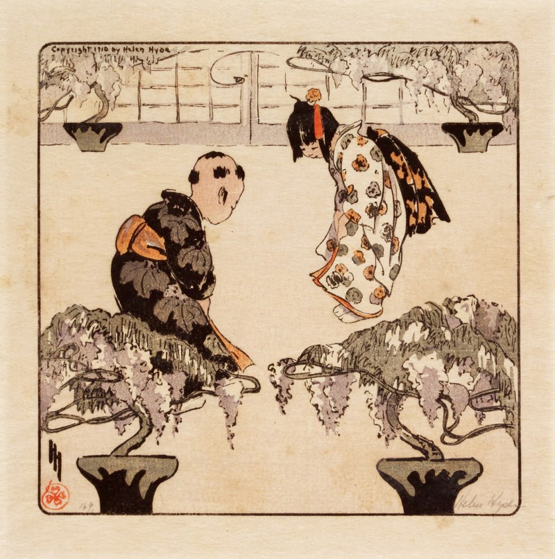
Woodblock Print by Helen Hyde

Another influence which inspired Alice Smith was the Japonisme aesthetic of the American etcher and engraver, Helen Hyde, who is best known for her colour etching process and woodblock prints which echoed the portrayal of Japanese women and children. Around about 1917, Smith undertook an intense study of Japanese colour woodblock prints, largely from the ukiyo-e school, which had been collected by her cousin, the Harvard professor Motte Alston Read. Motte Alston Read built up a collection of almost four hundred Japanese woodblock prints during the first two decades of the twentieth century, working meticulously to assemble a group of prints that were representative of the history of Japanese woodblock printing. She also began to teach etching during the 1920s, and one of her most famous students was Elizabeth O’Neill Verner.

Smith catalogued the collection and, began trying out with actual blocks and she taught herself how to print in the traditional Japanese manner.  She managed to produce a body of work which was characterized by sophisticated design and yet retained a sense of tranquillity.  In 1923 Smith helped the founding of the Charleston Etchers Club, a collaborative group that jointly acquired a press and shared expertise and criticism. However, by the late 1920s Smith gave up her work in prints and began to concentrate on watercolour.

Branford-Horry House by Alice Smith (1917)

Branford-Horry House by Alice Smith

Alice Smith is probably best remembered for her scenic views of Charleston streets and in 1917 she produced a beautiful graphite sketch of one of Charleston’s famous buildings, the Branford-Horry House.  The house was built for William Branford, a wealthy planter, in 1765-67 and is rated one of Charleston’s finest examples of a three-story brick Georgian townhouse, or “double house.” In 1801 it was purchased by Thomas Horry, who had married Branford’s daughter. His son, Elias Horry, president of the South Carolina Canal and Railroad Company, inherited the house and altered it somewhat. The house is a three-story Georgian brick building with stucco-covered walls. Unfortunately, in 1988, a speeding car crashed into the house, knocking out two of the columns and sending one into the front door of the house.

St Phillips Church Spire, Charleston by Alice Smith

St Phillips Church Spire by Alice Smith

Another graphite on paper sketch of a Charleston building is Alice’s depiction of St Philip’s church spire.  St. Philip’s is the oldest congregation in the United States south of Virginia.  The church was built in 1836 and the spire completed in 1850.  On November 7, 1973, it was added to the National Register of Historic Places and designated a National Historic Landmark.

House-Tops-View-from-69-Church-Street-689x1024

House Tops View from her home, 69 Church Street Charleston by Alice Smith

Alice Smith became so interested with the old buildings of Charleston that in 1917 in collaboration with her father, Daniel, she had a book published, The Dwelling Houses of Charleston, South Carolina, in which the authors demonstrate how the fashions of its architecture, often brought over from England, have maintained local characteristics and resulted in a distinctive style.

See the source image

For Alice and her father, it had not simply been their object to list or to describe these dwelling houses after the manner of a guidebook, but to show how the fashions of its architecture, though imported and constantly modified by new ideas brought chiefly from England, had yet maintained local characteristics, resulting in quite a distinctive style which has steadily persisted and been developed.

The Winter Vegetable Garden from the series A Carolina Rice Plantation of the Fifties by Alice Smith (c.1935)

The Winter Vegetable Garden from the series A Carolina Rice Plantation of the Fifties by Alice Smith (c.1935)

However, Alice Smith is best known for her lyrical and expressive depictions of the Carolina Lowcountry, the cultural region along South Carolina’s coast, including the Sea Islands. It was once known for its slave-based agricultural wealth in rice and indigo, crops that thrived in the hot subtropical climate, and is known now for its historic cities and communities, natural environment, cultural heritage, and tourism industry.  Smith summed up her love of the area saying:

“…my own lovely flat country of rice fields, of pinewoods, of cypress swamps, of oaks, lotus, and all their attendant feathered folk would yield me a full harvest if diligently spaded…”

Sunday Morning at the Great House by Alice Smith

Sunday Morning at the Great House from the series A Carolina Rice Plantation of the Fifties by Alice Smith (c.1935)

Around about 1924 Alice Smith changed her favoured painting medium and resorted to working with watercolours. After experimenting with oil paints and printmaking, Smith eventually settled on watercolour in which she would work for the rest of her life.  The reason being she said was that watercolours were most conducive to achieving the atmospheric effects she sought in her landscapes. Her landscape depictions are generally devoid of figures as she wanted to concentrate on the beauty of nature itself.  Many of her mature watercolours depict scenes from rural salt marshes.

Mending a Break in a Rice-Field Bank from the series A Carolina Rice Plantation of the Fifties

Mending a Break in a Rice-Field Bank from the series A Carolina Rice Plantation of the Fifties by Alice Smith (c.1935)

Alice Smith was also a noted illustrator, and contributed illustrations to two volumes her father, the historian Daniel Smith, who wrote about the history of Charleston and its architecture, as well as other books relating to South Carolina, most notably the 1936 book, A Carolina Rice Plantation of the Fifties, which contained thirty paintings in water-colour, by Alice Huger Smith, and a narrative by Herbert Ravenel Sass, with chapters from the unpublished memoirs of her father Daniel Huger Smith.

A Winter Field Still in Stubble from the series A Carolina Rice Plantation of the Fifties by Alice Smith

A Winter Field Still in Stubble from the series A Carolina Rice Plantation of the Fifties by Alice Smith (c.1935)

Alice was also engrossed in recording vanishing ways of life in South Carolina and her best-known work is the series of thirty watercolours known as her Rice Plantation Series which can be seen at the Gibbes Museum of Art in Charleston’s Historic District. She donated the Rice Plantation Series to the Gibbes in 1937.  Alice was able to pictorially tell the history of plantation life in the antebellum South, and by doing so, she took it upon herself to preserve that period in a series of nostalgic images that would be accompanied by her father’s memoirs and an essay on rice cultivation by the historian Herbert Ravenel Sass.  Alice made these plantation paintings during the height of the Jim Crow era, when black people in Charleston and throughout the country were subjected to humiliating discrimination and life-threatening abuse.  She was well aware of this as she, a single woman, lived in downtown Charleston, close to areas of extreme poverty, surviving only through the sale of her art.  As I said at the beginning, this period was in the 1930’s when Charleston was a city in limbo.  Gone were the days of the glorious affluence of the rice years with its economic revival still years away.  It was a time for those who lived in Charleston to hanker for the “good old days” and like to remember when times were relatively calm, when blacks knew their place and white planters were firmly in charge, when life for the privileged class was simple and wealth abundant.  In Alice Smith’s 1950 autobiography, Reminiscences, she wrote about change:

“…Small places and big places alike show it. Perhaps small happenings show it as sharply as great events, and one looks with surprise at the differences that one never noticed during the endless moments of what might be called trivial evolution…”

The Grove of Oaks from the series A Carolina Rice Plantation of the Fifties by Alice Smith (c.1935)

The Grove of Oaks from the series A Carolina Rice Plantation of the Fifties by Alice Smith (c.1935)

Her series of watercolours reflect her sense of change, and her profound nostalgia.  Maybe it was a nostalgic view of plantation life of the past but maybe it was pure fantasy but one has to remember paintings were made to be sold and maybe the public preferred this “happy plantation life” image rather than the cruelty that existed and by studying her depictions the public it probably helped people believe that the past was lovely.

A Visit from the old Mistress by Wilmslow Homer (1876)

A Visit from the Old Mistress by Winslow Homer (1876)

Almost sixty years before Alice Smith’s Plantation series the great American painter Winslow Homer created his 1876 work, A Visit from the Old Mistress, a picture depicting an idealised situation when blacks as freed slaves and living in a ramshackle cabin were shown as mixing happily with a white person, their former mistress of the “big house” who, until recently, owned them. It represented a scene from the present, a meeting of different classes and colour which caused an inevitable awkwardness when it was exhibited.

1 / 22
Woods at River Bend on Wando River, by Alice Smith (c. 1936)
 

Alice Smith donated the Rice Plantation Series to the Gibbes in 1937, and since that time the watercolours have been among the most popular works owned by the museum. The problem however was that the delicate works on paper were slowly deteriorating due to the acidic boards mounted to the back of each of the paintings. The acid then began to discolour the works and deposit on them brown spots known as foxing and with many of the watercolours, the damage was well advanced.

At the Head of the Valley by Alice Smith

The management of the Gibbes, realised the need to intervene, reverse the damage, and prevent future damage through professional conservation of Smith’s entire series of watercolours. To accomplish this, they established the Welsh-Blakely Fund, a substantial financial commitment that funded the five-year conservation project carried out by the Straus Center for Conservation at the Harvard University Art Museums.

Along the Beach by Alice Smith (c.1926)

Like many other leading painters from the Southern states of America during the early twentieth century, Alice Smith had a steadfast belief in the South, which was both idealized and energetically favourable, but this was simply down to her love of where she lived.  Smith was at the centre of Charleston’s artistic reawakening during the early twentieth century.

Larger memorial image loading...

Alice Ravenel Huger Smith died on February 03, 1958, aged 81 and is buried at Magnolia Cemetery in Charleston.